Home
Administration
Cantons
Culture
Economy
Education
Geography
History
Statistics
Various
FAQ
Index
Home |
Administration |
Cantons |
Culture |
Economy |
Education |
Geography |
History |
Statistics |
Various |
FAQ |
Index |
Mount Säntis is a spectacular site in the northeast of Switzerland. With 2502 meter above sea level, it is the highest mountain in the area and therefore very exposed to wind and weather. It is also perfectly suited as a host for terrestrial communication devices. At the top, there are many antennas, some of them attached to a pylon that rises 123 meter above ground. You can hike up to the top - rather strenuous but very awarding - or you can ride the aerial tramway. There are restaurants at the top and - if weather permits - you will enjoy a georgeous view. You will not only see the Swiss alps, but also way into Austria and Germany.
See www.saentisbahn.ch for more details (the website is available in German, French and English).
Hint: Click on the images for an enlargement.
 |
 |
| Location of mount Säntis, Appenzell Innerrhoden, Switzerland |
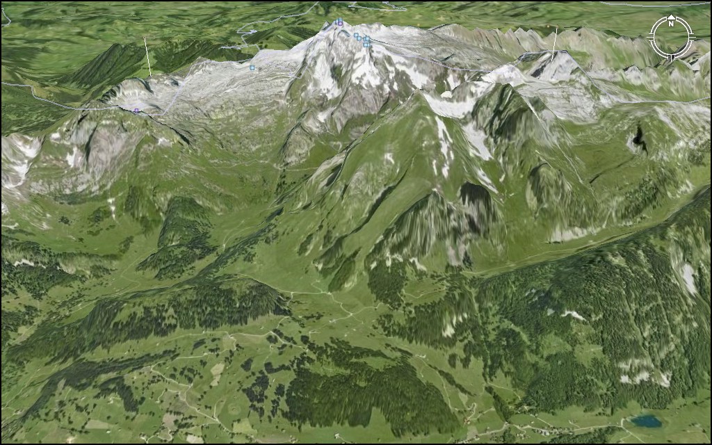
Mount Säntis seen from 8 km above ground |
 |
 |
| Mount Säntis looking from south towards north | Mount Säntis looking from north towards south |
Hint: Click on the images for an enlargement.
 |
 |
| Mount Säntis seen from Schwägalp (base of the aerial tramway) |
Station at the top of mount Säntis seen from Schwägalp |
 |
 |
| Looking from mount Säntis down to Schwägalp | Top of mount Säntis |
 |
 |
| Top of mount Säntis with mountain range "Kurfirsten" in the distance |
Platform at the top of mount Säntis |
 |
 |
| Tibet monument at the top of mount Säntis | Covered stairway and meteo station on top of mount Säntis |
 |
 |
 |
| Meteo station and antenna pylon | Antenna pylon, 123 meters high | Inside the antenna pylon, looking up |
 |
| Panorama looking towards north |
 |
| Panorama looking towards south ("Kurfirsten") |
Home | Administration | Cantons | Culture | Economy | Education | Geography | History | Statistics | Various | FAQ | Index | Search
| www.about.ch is brought to you by TRAMsoft GmbH The company for hi-tech watches, global positioning systems (GPS) and mobile computing (This document does not require any browser specific features and is compliant with the W3C standard "HTML 4.01 Transitional") index.html / 16-Feb-2012 / reto ambühler |